Construction progress photos are most valuable when they show more than a few impressive aerial views.
A strong set of progress photos should help contractors, owners, developers, and project managers understand what has changed, what work is underway, and which areas may require additional attention. When those photos are captured consistently throughout construction, they create an organized visual history of the project.
The challenge is knowing what should be photographed during each visit.
Random photos taken from different locations may show activity, but they can be difficult to compare from one month to the next. A planned construction photo checklist helps ensure that important areas are documented before conditions change or work becomes concealed.
Here are the most important views to include during a construction progress drone flight.
1. Wide Views From Each Corner of the Property
Every progress flight should begin with wide aerial views showing the entire project.
Capturing the property from each corner provides a clear overview of the building, sitework, access routes, surrounding properties, and active construction areas. These images help viewers understand how individual scopes relate to the overall site.
Wide views may show:
- Overall building progress
- Clearing and grading
- Material and equipment locations
- Parking and paving
- Construction entrances
- Stormwater areas
- Neighboring roads and properties
- Areas reserved for future work
These photos are especially useful for owners and company leaders who do not regularly visit the project.
Using approximately the same altitude, direction, and camera angle during each flight makes the images easier to compare over time.
2. Straight-Down Overhead Photos
Straight-down aerial photos provide a perspective that cannot easily be captured from the ground.
These images can show the layout of the entire property, including building footprints, parking areas, utilities, access routes, and material staging. They are particularly helpful during sitework because they clearly show the relationships between different areas.
Overhead photos may be useful for reviewing:
- Building and foundation layouts
- Road and parking configurations
- Underground utility routes
- Storm-drainage installation
- Sidewalks and accessible routes
- Material laydown areas
- Construction sequencing
- Overall use of available space
Drone photos should not replace surveys, measurements, civil drawings, or official as-built documentation. However, an overhead view can add valuable visual context when the project team is discussing current site conditions.
3. Construction Entrances and Access Routes
Access conditions can affect deliveries, equipment movement, emergency access, and the ability of subcontractors to begin their work.
Each flight should document the primary construction entrance and any temporary access routes being used around the property.
These images may help the team review:
- Delivery access
- Temporary roads
- Mud or damage at entrances
- Traffic congestion
- Equipment movement
- Subcontractor parking
- Fire-department access
- Routes needed for upcoming work
As the project progresses, access routes may need to change. A current aerial photo gives the team a shared visual reference for discussing those adjustments.
For a deeper look at this subject, read How Drone Photos Help With Construction Site Logistics.
4. Material and Equipment Staging
Materials and equipment can occupy a significant portion of an active jobsite.
Progress photos should show where major materials are stored, how equipment is positioned, and whether staging areas are beginning to interfere with other construction activities.
Important items may include:
- Structural steel
- Roofing materials
- Pipe and drainage structures
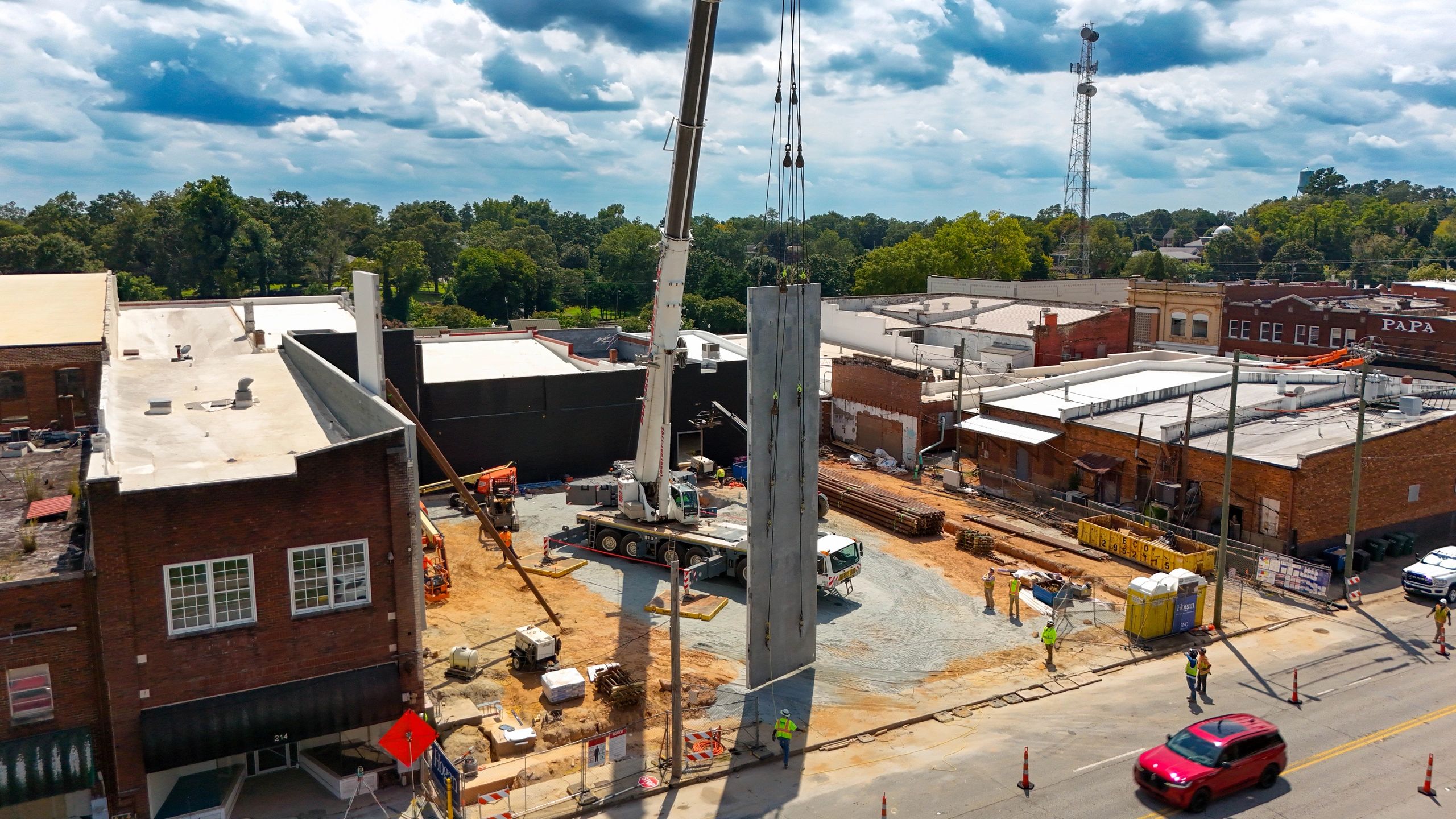
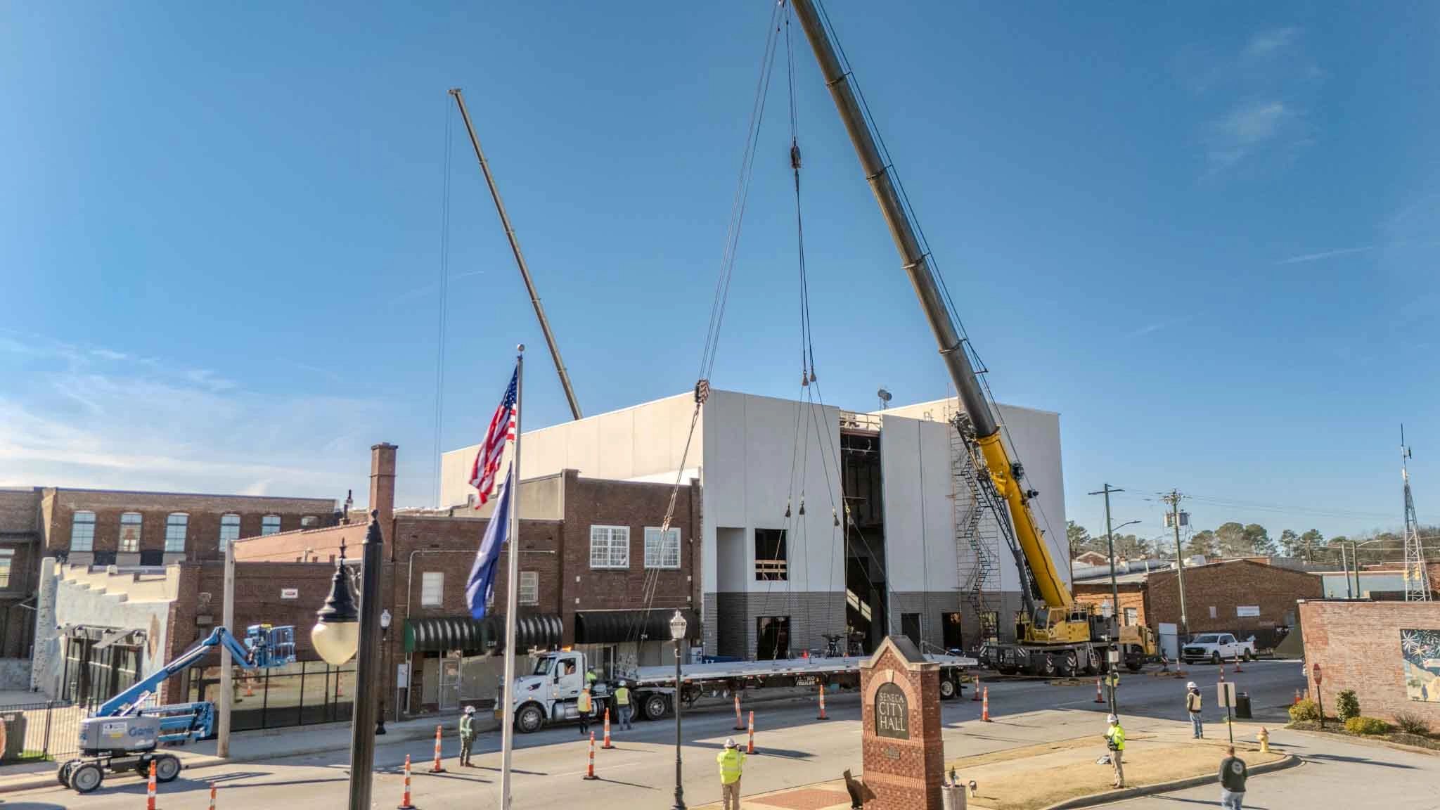
- Precast or modular components
- Masonry materials
- Heavy equipment
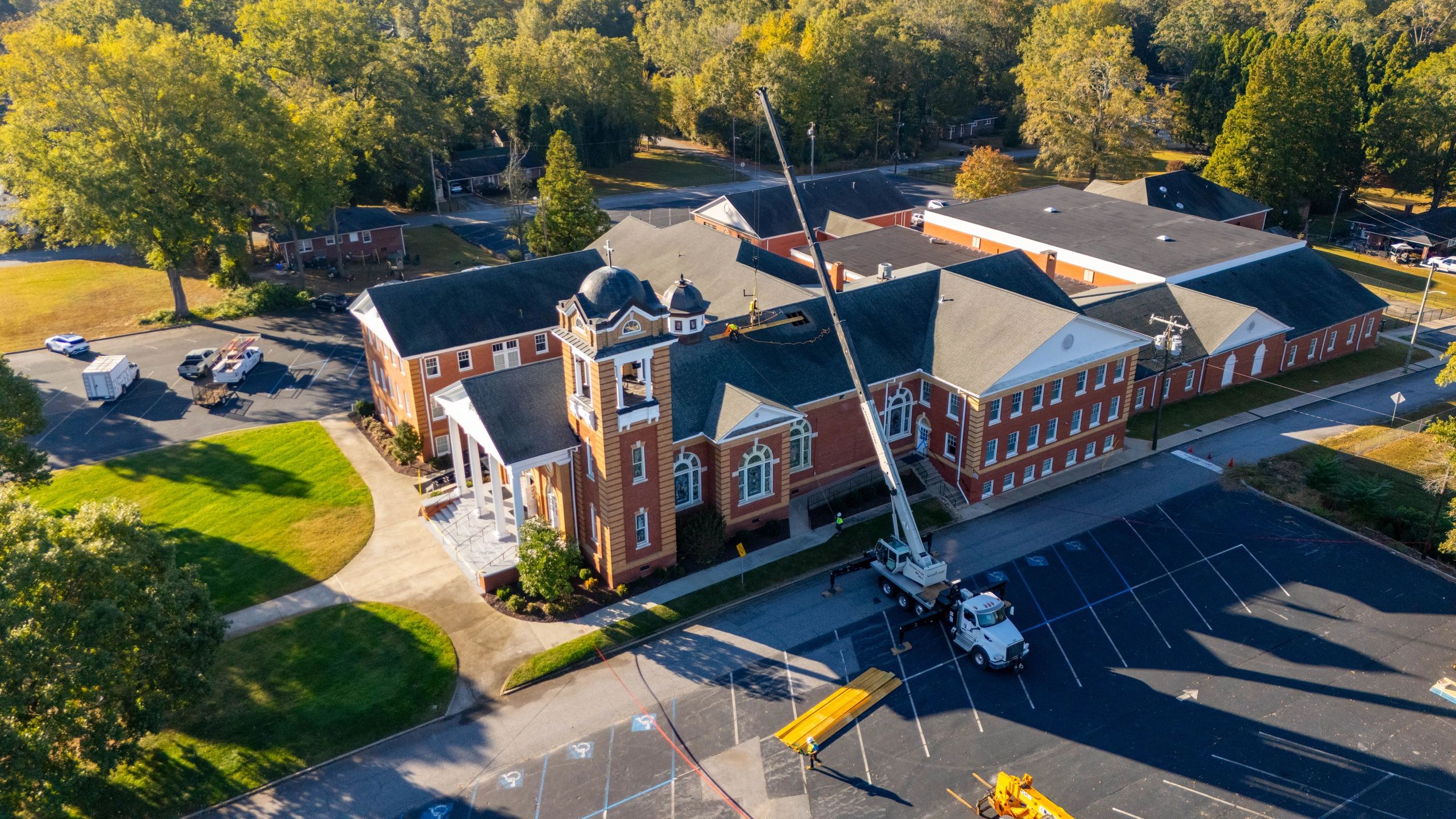
- Lifts and cranes
- Temporary buildings and storage containers
- Materials awaiting installation
These photos can also add context when reviewing stored materials for a pay application. Close-up ground photos, invoices, delivery tickets, and other records may still be required, but the aerial view shows where the materials are located in relation to the project.
Learn more in How Drone Photos Strengthen Construction Pay Applications.
5. Sitework and Grading Progress
Sitework can change quickly and should be documented throughout the project.
Aerial photos provide a clear way to capture large areas of grading, drainage, utility, and paving work that would otherwise require numerous ground-level images.
Progress flights should document:
- Clearing and rough grading
- Building pads
- Major cuts and fills
- Slopes and embankments
- Detention or retention areas
- Erosion-control measures
- Curb and gutter
- Stone base
- Asphalt paving
- Landscaping and stabilization
Photos should include both completed areas and locations where work is still underway.
Consistent images may help the project team recognize areas where visible progress has slowed or where site conditions have changed since the previous visit.
6. Underground Utilities Before They Are Covered
Underground work is one of the most important construction phases to document because it will eventually disappear beneath backfill, pavement, concrete, or landscaping.
When possible, drone flights should be coordinated around major utility installations rather than waiting for the next normal monthly visit.
Photos may document:
- Storm-drainage routes
- Sanitary-sewer installation
- Water-line installation
- Electrical and communication pathways
- Manholes and drainage structures
- Open trenches
- Connections to existing systems
- Utility conflicts
- Conditions before backfilling
Aerial photography does not replace required inspections, testing, surveys, or as-built drawings. It provides an additional record showing the general location and surrounding conditions of the work.
Once the area has been covered, these photos may help the team better understand what previously occurred in that location.
7. Foundations and Structural Progress
Once foundations and structural work begin, the building starts taking recognizable shape.
Progress photos should document the building footprint and major structural milestones, including:
- Footings and foundations
- Slab preparation
- Concrete placement
- Structural-steel erection
- Precast installation
- Wood or metal framing
- Roof decking
- Large equipment placement
- Building additions and connections
Wide aerial views show how the structure relates to the surrounding site, while closer images provide more detail about the current milestone.
Photos taken from consistent locations make structural progress easier to compare between visits.
8. Building Exterior and Roof Conditions
As the building approaches dry-in, each flight should include detailed views of the exterior and roof.
Important areas may include:
- Roofing installation
- Exterior wall systems
- Windows and storefronts
- Exterior sheathing
- Canopies and covered walkways
- Building entrances
- Loading areas
- Roof-mounted equipment
- Remaining exterior openings
Aerial photography provides access to roof and upper-wall perspectives that may be difficult to capture safely from the ground.
These images can identify visible areas that deserve a closer field review, but they should not replace required roof inspections, quality-control procedures, or professional evaluations.
9. Drainage and Stormwater Areas
Drainage conditions should be documented throughout construction, particularly after significant sitework or major weather events.
A progress flight may include:
- Detention and retention areas
- Ditches and swales
- Storm-drainage structures
- Roof-drain discharge locations
- Erosion-control measures
- Low areas holding water
- Stabilized and disturbed soil
- Temporary drainage routes
Pre-construction photos are especially valuable because they establish how drainage areas and neighboring conditions appeared before work started.
If a drainage question arises later, the project team can compare the original condition with more recent images.
Read Why Pre-Construction Drone Photos Matter for more information about establishing a visual baseline.
10. Current Milestones and Areas of Concern
A standard checklist creates consistency, but every flight should also focus on the work that matters most at that point in the schedule.
Before the drone visit, the project manager or superintendent may identify specific areas that need additional coverage.
Examples include:
- A major concrete placement
- New structural work
- An unexpected site condition
- A utility conflict
- Weather-related damage
- Additional clearing or grading
- Work related to a change order
- An area scheduled to be covered
- A location discussed during an owner meeting
These targeted photos help connect the standard progress record to the project’s current priorities.
When possible, capture a wide image establishing the location followed by closer views showing the specific condition.
11. Surrounding Property Conditions
Construction documentation should not stop at the project boundary.
Photos may also need to capture nearby roads, sidewalks, curbs, drainage areas, buildings, fences, and neighboring properties. These areas can be affected by deliveries, equipment movement, drainage changes, or ongoing construction activity.
Surrounding-condition photos are especially important:
- Before construction begins
- Before heavy equipment mobilizes
- Before major deliveries
- After severe weather
- When access conditions change
- When adjacent work occurs
- At final completion
A dated visual record may help answer later questions about when a condition appeared or how an area changed.
12. Completed Work and Remaining Work
A useful progress set should show both what has been completed and what remains.
It can be tempting to photograph only the most active or impressive areas. However, unfinished areas may be equally important to the project team.
Photos should make it possible to identify:
- Completed exterior scopes
- Active work areas
- Areas that have not started
- Temporary conditions
- Remaining site improvements
- Work awaiting another trade
- Areas approaching a major milestone
This balanced approach gives the project team a more accurate picture of current conditions.
Why Consistent Camera Angles Matter
Consistency is one of the biggest differences between professional progress documentation and occasional jobsite photography.
If every flight is captured from different locations, it becomes difficult to determine how much the project changed. Using similar flight paths, altitudes, directions, and camera angles creates a visual timeline.
A good recurring flight plan may include:
- One wide image from each corner
- One or more straight-down overhead views
- Consistent building elevations
- Roof and exterior views
- Access and staging areas
- Major sitework and drainage locations
- Detail photos of current milestones
The exact checklist should be adjusted as the project progresses, but the core views should remain consistent.
How Often Should Progress Photos Be Taken?
Many commercial construction projects benefit from one scheduled drone flight each month. This frequency can support owner updates, progress meetings, pay applications, and general project documentation.
Faster-moving projects may need biweekly flights during major phases such as grading, underground utilities, structural erection, roofing, or final sitework.
Smaller projects may benefit from milestone-based flights:
- Before construction
- After clearing and grading
- During underground utilities
- During structural construction
- At dry-in
- During final site improvements
- At substantial completion
- After final landscaping and punch-list work
The right schedule depends on how quickly conditions are changing and which scopes need to be documented.
How Should Construction Photos Be Organized?
Even high-quality photos lose value when they are difficult to locate.
Each delivery should be organized by project and date. File names or folders may also identify the general view, building area, or milestone being documented.
A simple structure could include:
- Project name
- Flight date
- Wide aerial views
- Overhead views
- Building progress
- Sitework and utilities
- Access and staging
- Current milestones
This organization makes it easier to find images during owner meetings, pay-application reviews, change-order discussions, closeout, or later project questions.
The goal is to create a usable project record—not simply a folder filled with unrelated images.
Professional Construction Progress Photography
Construction progress photos are most effective when they are planned before the flight and captured consistently throughout the project.
The right checklist gives contractors and owners a clear way to follow visible progress, review current site conditions, communicate with off-site stakeholders, and preserve a record before conditions change.
Drone photography does not replace schedules, surveys, inspections, daily reports, or written project documentation. It strengthens those processes by adding an organized visual overview of the jobsite.
Construction Drone Photography in Upstate South Carolina
Owens Aerial provides professional construction progress photography for general contractors, developers, owners, and project teams throughout Greenville, Simpsonville, Fountain Inn, Laurens, Anderson, Spartanburg, Greenwood, and surrounding areas of Upstate South Carolina.
With a professional background in construction, Owens Aerial understands which views are useful to project managers, superintendents, owners, and contractors. Flights are completed by an FAA-certificated and insured drone operator, with organized delivery and dependable turnaround.
Whether your project needs a pre-construction baseline, milestone photography, or recurring progress documentation, Owens Aerial can develop a photo checklist and flight schedule around your project’s needs.
Contact Owens Aerial at brayden@owensaerial.com or (864) 871-3260 to request a free quote for construction drone photography in Upstate South Carolina.