Construction delays rarely begin as one major, obvious problem. They often start with smaller issues—an access route that is not ready, materials stored in the wrong location, sitework falling behind, or a conflict that is not discovered until another trade arrives.
By the time the issue becomes obvious, it may already be affecting labor, deliveries, inspections, and the project schedule.
Consistent drone progress photography gives contractors, owners, and project managers a clearer view of the entire jobsite. It can help teams recognize developing concerns, improve coordination, document current conditions, and make decisions before smaller problems become larger delays.
Drone photography does not replace an updated construction schedule, field inspections, surveys, or direct communication with subcontractors. However, it can provide visual information that is difficult to capture from the ground.
Here are seven ways construction drone photography can help project teams reduce the risk of delays.
1. Establish Existing Conditions Before Work Begins
One of the most valuable drone flights happens before clearing, demolition, or grading begins.
Pre-construction photos establish a visual baseline of the property and surrounding areas. This documentation can show:
- Existing roads, sidewalks, and curbs
- Neighboring buildings and properties
- Drainage areas, ponds, and ditches
- Trees, vegetation, and existing ground conditions
- Fences, signs, and utility structures
- Proposed access and staging areas
- Nearby traffic patterns
Having this information available can help the project team answer questions about how the site looked before construction.
It can also support early planning. Aerial photos may reveal limited access, tight staging areas, nearby structures, difficult slopes, or other conditions that must be considered before equipment and materials begin arriving.
The earlier these conditions are understood, the more time the team has to develop a practical plan.
2. Identify Site-Logistics Problems
Poor site logistics can create delays even when the building work itself is moving forward.
Construction entrances may become congested. Materials may occupy an area needed by another trade. Equipment could block a future access route. A temporary parking plan may stop working as more subcontractors arrive.
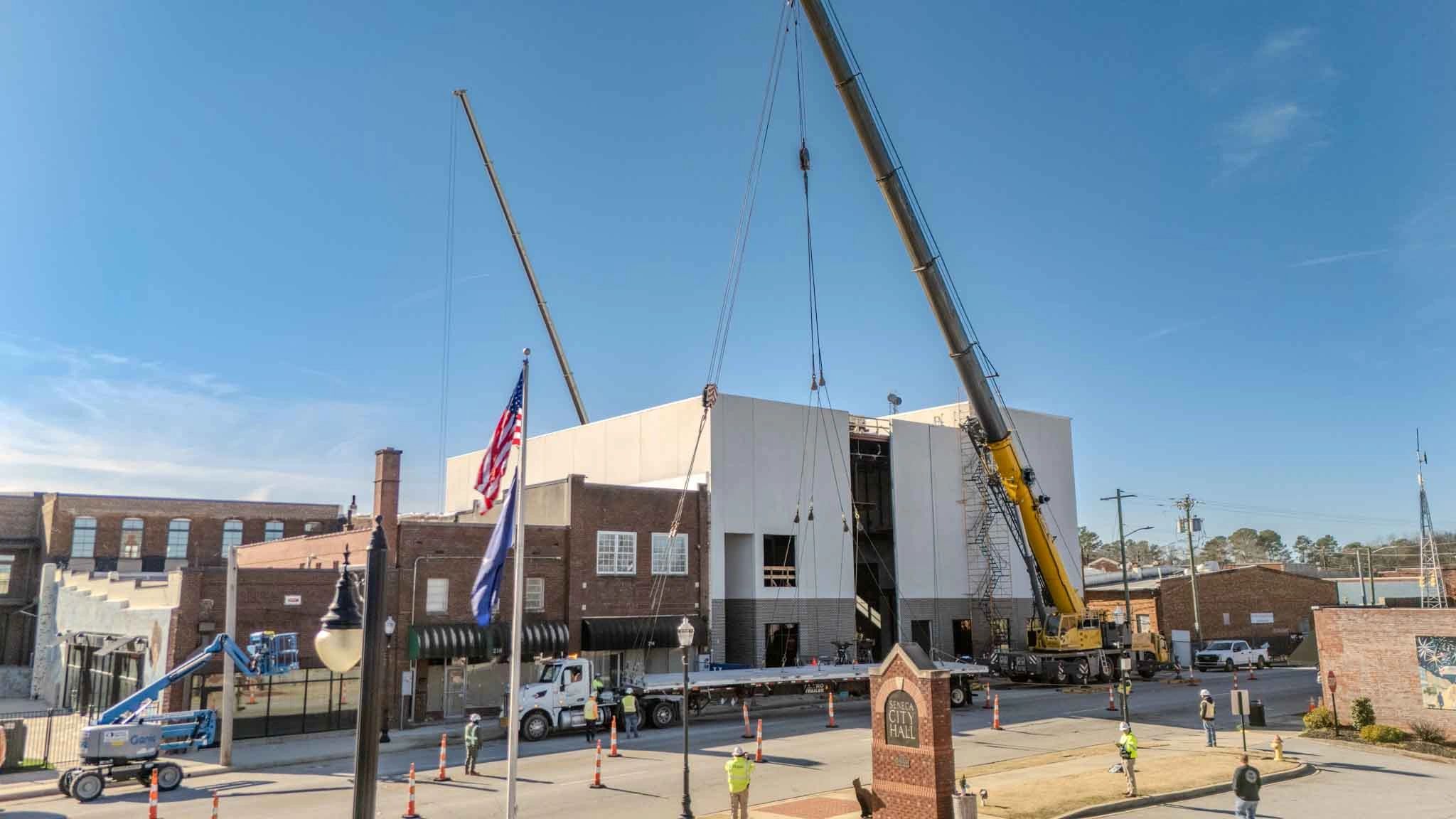
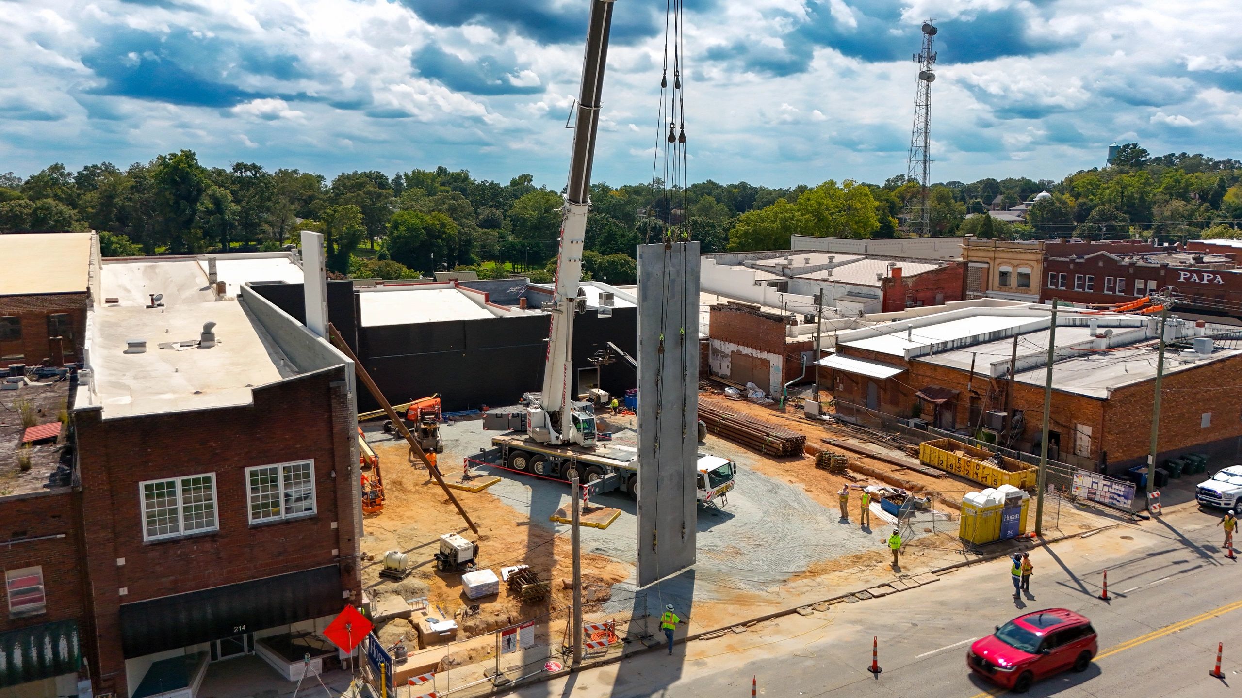
These conditions are not always easy to understand from ground-level photos. Aerial images can show the relationship between the building, access roads, material storage, equipment, temporary facilities, and active work areas.
Drone photos can help teams review:
- Construction entrances and delivery routes
- Material laydown and storage areas
- Equipment locations
- Crane and lift access
- Temporary parking
- Dumpster placement
- Areas reserved for future work
- Emergency and fire-department access
This visual information can be especially helpful during superintendent meetings and subcontractor coordination discussions.
The team can look at the same current image, identify a potential conflict, and adjust the plan before the conflict affects work in the field.
3. Make Progress Easier to Compare
A project manager may know what work was expected to happen during the previous month, but determining whether every exterior area is progressing as planned can take time.
Consistent drone photography makes comparisons easier.
When photos are captured from similar locations and angles during each visit, the project team can quickly see how the site changed between flights. Building pads, foundations, structural work, roofing, exterior walls, paving, and other large scopes become easier to compare.
These images may help the team notice:
- Areas where visible progress has slowed
- Work that appears out of sequence
- Exterior scopes that have not started
- Site improvements that are approaching a critical milestone
- Areas that require additional field review
- Differences between planned and visible site conditions
Drone photos should not be used alone to determine whether a contractor is meeting the schedule. Interior work, procurement, inspections, and other activities may not be visible from the air.
However, aerial photos can draw attention to areas that deserve a closer look. This gives the project team an opportunity to investigate the issue before it becomes a larger schedule concern.
4. Improve Coordination Between Trades
Construction delays frequently occur when one trade cannot begin because another area is incomplete or inaccessible.
For example, a concrete crew may need an area cleared before placing sidewalks. A utility contractor may need access through a space being used for material storage. A paving contractor may be unable to mobilize until heavy equipment and deliveries are finished in that area.
A current aerial image provides a shared reference for these discussions.
Instead of relying only on written descriptions or outdated site plans, the team can see the actual condition of the property. This can make it easier to coordinate:
- Upcoming deliveries
- Equipment mobilization
- Concrete placements
- Utility installation
- Paving sequences
- Landscaping
- Building-envelope work
- Temporary access changes
The image does not replace the project drawings or schedule, but it helps connect those documents to current field conditions.
This is particularly useful when coordinating subcontractors who have not recently visited the project. A current aerial view can help them understand access, staging, and site-readiness before their crews arrive.
5. Document Underground Work Before It Is Covered
Underground utilities can create significant delays when conflicts or missing information are discovered later.
Storm drainage, sanitary sewer, water lines, electrical systems, and other utilities eventually disappear beneath backfill, stone, pavement, or landscaping. Once that happens, understanding the previous condition becomes much more difficult.
Drone flights scheduled during utility installation can document:
- General utility routes
- Open trenches
- Drainage structures and manholes
- Connections to existing systems
- Areas affected by conflicts
- Relationships between utilities and foundations
- Conditions before backfilling
Aerial photos are not a replacement for surveyed as-built drawings, inspections, testing, or required close-up documentation. They provide additional visual context.
If a question arises later, the project team may be able to reference the images to better understand where work occurred and what the site looked like before it was covered.
Because underground work can progress quickly, this phase may require milestone flights rather than relying only on a regular monthly visit.
6. Help Off-Site Stakeholders Make Faster Decisions
Owners, architects, engineers, consultants, and company leadership may not be able to visit the project every week.
When these stakeholders do not have current information, decisions can take longer. They may need additional photos, explanations, meetings, or site visits before they feel comfortable providing direction.
Aerial photos give them a clear overview of the property without requiring them to be physically present.
A well-organized progress update can show:
- Current building and site progress
- Areas related to an open decision
- Access and staging conditions
- The location of a potential conflict
- Work completed since the previous update
- Upcoming exterior milestones
This does not eliminate necessary site visits or professional inspections. It gives decision-makers better information before meetings and discussions take place.
When everyone is looking at the same current images, questions can be more specific and decisions may be easier to reach.
7. Create a Record of Conditions Affecting the Schedule
Not every delay can be prevented. Weather, unforeseen conditions, design changes, utility conflicts, and owner-requested revisions can still affect a project.
When these situations occur, consistent documentation helps the team understand what happened and when it happened.
Drone photography may help document:
- Significant rain or storm conditions
- Flooded or inaccessible work areas
- Changes to construction entrances
- Unexpected site conditions
- Additional clearing or grading
- Utility conflicts
- Material deliveries and staging
- Work completed before a change occurred
- Conditions before and after corrective work
Drone photos do not replace daily reports, written notices, schedule updates, meeting minutes, or formal change-order documentation. They add visual context to those records.
Instead of relying entirely on memory, the project team has dated images showing how the site changed throughout construction.
How Often Should Drone Progress Photos Be Taken?
The best flight frequency depends on the project’s size, pace, and complexity.
Many commercial projects benefit from one scheduled flight each month. This creates a consistent record that can support owner updates, progress meetings, pay applications, and general project documentation.
Faster-moving projects may benefit from biweekly flights during major phases such as:
- Clearing and grading
- Underground utilities
- Foundations
- Structural erection
- Roofing
- Exterior improvements
- Paving and final sitework
Additional milestone flights may be useful:
- Before construction begins
- Before underground work is covered
- After a major weather event
- When site conditions change
- At dry-in
- At substantial completion
- After final landscaping and punch-list work
The goal is to avoid large gaps in the project’s visual history. Important work can begin, change, and become concealed between widely spaced visits.
What Should a Progress Flight Include?
Construction drone photography should provide more than a few attractive aerial images. The photos should be consistent, organized, and useful to the people managing the project.
A typical construction progress flight may include:
- Wide views from each corner of the property
- Straight-down overhead photos
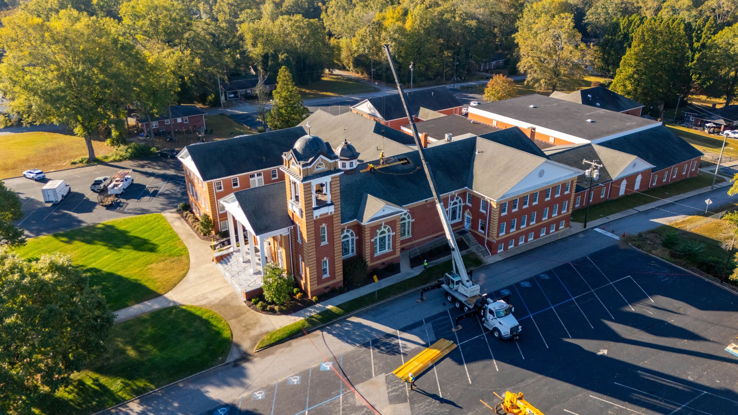
- Building exterior and roof progress
- Construction entrances and access routes
- Material and equipment staging
- Active sitework
- Parking and paving progress
- Drainage areas and surrounding conditions
- Detailed views of current milestones
Using similar flight paths and camera angles during each visit makes comparisons much easier.
The images should also be organized by project and date. This allows the team to quickly locate the correct photos during a progress meeting, owner discussion, change-order review, or later project question.
Drone Photos Are a Project-Management Tool
A drone cannot manage the construction schedule or solve a coordination problem by itself.
Its value comes from giving the project team a current, organized view of conditions across the entire site. That information can help contractors identify developing concerns, prepare for upcoming work, communicate with stakeholders, and document conditions before they change.
The sooner a potential issue is recognized, the more options the team typically has for responding to it.
That is why construction drone photography works best when it is planned as part of the project’s documentation process—not scheduled only after a problem occurs.
Construction Drone Photography in Upstate South Carolina
Owens Aerial provides professional construction progress photography for general contractors, developers, owners, and project teams throughout Greenville, Simpsonville, Fountain Inn, Laurens, Anderson, Spartanburg, Greenwood, and surrounding areas of Upstate South Carolina.
With a background in construction and experience around active jobsites, Owens Aerial focuses on capturing the areas that matter to project managers, superintendents, owners, and contractors.
Every commercial flight is completed by an FAA-certificated remote pilot following applicable Part 107 requirements. Images are professionally captured, organized by date, and delivered with dependable turnaround.
Whether you need a pre-construction baseline, milestone photography, or recurring progress flights, Owens Aerial can develop a documentation plan that fits your project.
Contact Owens Aerial at brayden@owensaerial.com or (864) 871-3260 to request a free quote for construction drone photography in Upstate South Carolina.