Why Aerial Imagery Is a Game-Changer in Real Estate Marketing
In today’s competitive property market, standout visuals aren’t just an advantage—they’re a necessity. A growing number of listings now feature professional drone photography, and for good reason: properties showcased with aerial imagery receive significantly more online engagement and faster time-to-sale. For sellers and real estate professionals alike, capturing a property from above offers a unique perspective that ground-level photography simply can’t match.
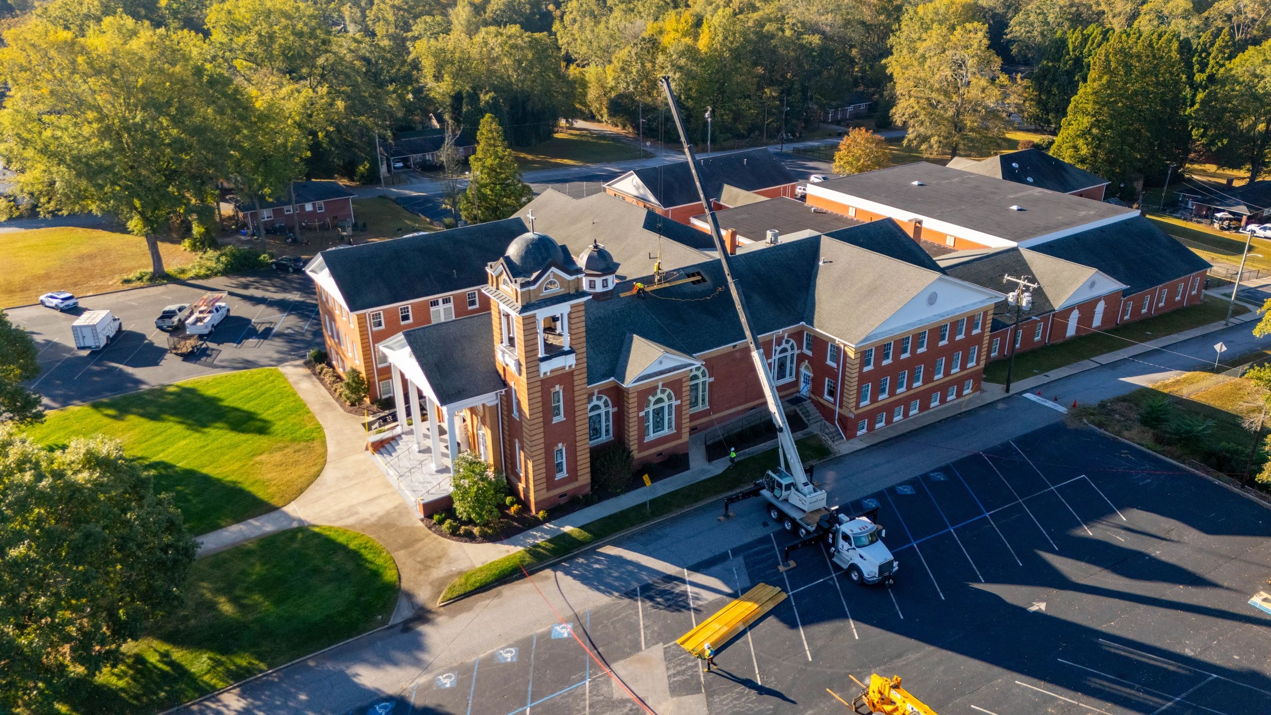
Aerial shots highlight not just the home itself, but its context—the lot size, proximity to lakes or golf courses, rooftop features, and surrounding neighborhood appeal. This is especially valuable in markets with scenic landscapes or high-end developments where first impressions drive buyer interest.
Choosing the right drone photographer means understanding more than just flight controls—it’s about visual storytelling, compliance with FAA regulations, and technical mastery of camera settings for optimal lighting and resolution.
In this guide, you’ll learn how to assess a photographer’s experience, review their portfolio critically, ensure proper licensing and insurance, and understand the types of deliverables that best serve real estate marketing—from cinematic walkthroughs to still image packages tailored for your website and social media platforms.
Verify FAA Part 107 Certification in 3 Key Steps
Choosing a qualified drone photographer starts with confirming their FAA Part 107 license—a critical step for legal and safe operations. Without this certification, flights may violate federal regulations, exposing you to liability and potential project delays.
1. Request Proof of Current Part 107 License Ask the pilot directly for documentation showing an active FAA remote pilot certificate. A legitimate license includes a unique identifier and expiration date. Pilots should readily provide a copy without hesitation, as this is standard practice.
2. Use the FAA’s Online Verification Tool Visit the FAA’s official license lookup system to validate the license number provided. This free tool confirms not only authenticity but also ensures the pilot’s authorization hasn't lapsed or been restricted. Never rely solely on a screenshot—verify independently.
3. Confirm Location-Specific Compliance Ensure the pilot is authorized to fly in your area, especially in controlled airspace near airports or urban zones like downtown Greenville or Charleston. A compliant operator will have flight authorization via the FAA’s Low Altitude Authorization and Notification Capability (LAANC) system.
Pro tip: Always ask for proof of liability insurance—this complements legal compliance and protects all parties in the event of unforeseen incidents.
Don’t Overlook Drone Operator Insurance—Here’s Why It Matters
When hiring a drone photographer, one of the most critical yet overlooked factors is liability insurance. Without it, you could be exposed to significant financial risk if an accident occurs during a flight. Professional drone operators should carry comprehensive liability coverage to protect against potential property damage or bodily injury—common concerns when flying near buildings, vehicles, or people.
Look for policies that offer at least $1 million in coverage per incident, which is the standard baseline for commercial drone work across most regions, including areas with strict urban flight regulations. This level of protection ensures that if a drone malfunctions or causes unexpected damage—like a crash on a rooftop or interference with construction equipment—the costs won’t fall on you.
Additionally, confirm that the policy specifically covers aerial operations under FAA Part 107 guidelines, the federal standard for commercial drone use in the U.S. Coverage under these rules verifies that the operator is compliant, trained, and taken seriously as a professional.
You can also ask if the insurance includes equipment coverage and personal injury protection, which adds another layer of security. Always request a certificate of insurance (COI) before booking—this verifies active coverage and can be required by property managers, local municipalities, or event coordinators in cities like Charleston, Greenville, or Columbia.
5 Essential Aerial Shot Types Every Property Needs
Capturing stunning aerial content starts with a strategic shot list that highlights a property’s most compelling features. Whether you're showcasing luxury homes in Asheville or commercial developments in Charleston, these five shot types form the foundation of every effective drone photography plan.
1. The Hero Wide-Angle Start with a sweeping wide shot that captures the entire property and its surroundings. This perspective establishes context and emphasizes location advantages—like proximity to coastline, mountains, or urban centers—making it a cornerstone for real estate and development marketing. 2. Roofline & Architectural Overviews Fly parallel to the roofline to accentuate design details—angled gables, solar panel arrays, or textured materials. These shots are especially effective for high-end residential and commercial listings where craftsmanship matters. 3. Approach Sequences Simulate the journey toward the property, starting from the street or skyline and ending at the front entrance. This cinematic technique builds narrative momentum and helps buyers visualize arrival and access. 4. Drone-Eye Perspective of Key Features Zoom in on standout amenities like swimming pools, outdoor kitchens, rooftop decks, or landscaping. These close-up, elevated views spotlight investment-worthy elements in striking clarity. 5. Day-to-Dusk Transitions Time your shoot to capture both daylight and twilight. The golden hour glow and nighttime lighting reveal a property’s full visual potential, ideal for social media and listing features.
Know What You’re Paying For: Breaking Down Pricing, Turnaround, and Process
Choosing the right drone photographer starts with understanding how services are priced, how long delivery takes, and what to expect from start to finish. Here’s how different service models stack up:
Pricing Structures:
- Hourly Rate: Typically $150–$300/hr for flight time only; ideal for short site inspections in Greenville or Spartanburg.
- Per Project: Flat fees ranging from $500–$2,500+, depending on complexity—best for full real estate marketing packages or multi-phase construction documentation.
- Day Rate: $800–$1,500/day for extended coverage, commonly used for large commercial developments or time-lapse sequences.
Delivery Timelines:
- Standard Turnaround: 5–7 business days for edited stills and basic video cuts.
- Rush Services: Available in as little as 24–48 hours, often at 1.5x the base rate, ideal for urgent property listings in Asheville or Charlotte markets.
- Full Post-Production Packages: Include color grading, cinematic editing, and 3D mapping, extending delivery to 10–14 days.
Service Process Comparison:
- Basic Providers: Offer flight and raw footage; client handles all editing.
- Mid-Tier Services: Include flight, selective editing, and one revision.
- Comprehensive Solutions: Feature pre-flight planning, property scans, annotated stills, and multi-format deliverables (web, print, social).
Always confirm deliverables, revision policies, and travel fees upfront—especially for rural or hard-to-reach locations.
What You Need to Know Before Hiring a Drone Photographer
Do drone photographers need special licenses or certifications? Yes, in most regions, professional drone photographers must hold a Part 107 license (or equivalent) issued by the aviation authority. This certification ensures they understand airspace regulations, flight safety, and operational limits. Always verify that your photographer is certified and carries proper insurance to cover potential liability during flights.
Are permits required for drone flights in urban or restricted areas? Absolutely. Flying near airports, over crowds, or in protected zones often requires additional airspace authorization through the national aviation system. A qualified drone photographer should know how to apply for these permits and file flight plans to remain compliant, especially in cities like Charleston or Greenville where airspace is tightly monitored.
Who owns the rights to the aerial photos and video captured? Typically, the photographer retains the copyright unless otherwise stated in a contract. However, licensing agreements usually grant you usage rights for marketing, real estate listings, or client presentations. Be sure to clarify how and where you can use the content—especially for commercial or editorial purposes.
What safety protocols should drone operators follow on-site? Reputable pilots perform pre-flight risk assessments, maintain visual line-of-sight, avoid flying in poor weather, and establish safe launch zones. They should also carry liability insurance and be prepared to adjust for pedestrian traffic, especially on construction sites or busy event venues.
Can drone footage be used legally in real estate listings or commercial promotions? Yes—but only if the flight was conducted legally and all privacy laws were respected. Avoid capturing neighboring properties without consent, and always ensure compliance with local ordinances, particularly in residential neighborhoods across the Southeast region.
Make the Right Choice for Your Aerial Imaging Needs
Choosing the right drone photographer comes down to more than just a bird’s-eye view—it’s about precision, professionalism, and peace of mind. Start by verifying proper licensing and insurance, ensuring the operator complies with FAA regulations and carries liability coverage tailored to drone operations. Review their portfolio closely, focusing on experience in your specific use case, whether it’s real estate in Greenville, construction progress in Spartanburg, or commercial site documentation across Upstate South Carolina. High-resolution imagery and stable 4K video are standard expectations, but expertise in photogrammetry or thermal imaging can add serious value for industrial clients.
Don’t overlook communication and workflow. A reliable provider will offer clear timelines, post-processing details, and responsive collaboration throughout your project. Always ask about data ownership, turnaround time, and how they handle challenging weather or flight restrictions. These factors directly impact your timeline and deliverables.
Take the next step: define your project goals, request sample reels or stills from local shoots, and schedule consultations with qualified drone pilots in your area. With the right professional, you’re not just getting aerial shots—you’re gaining actionable visual data that elevates your project. Make an informed decision and see your vision take flight.